
It was beautiful when I left for school in the morning but it cloudy by afternoon which was a bit disappointing. When I got home I continued my research into local mountains and hiking trails. I figured I might go climb a mountain if I convinced myself enough. I actually loathe hiking in cloudy weather. It almost negates the experience because of the drab overtones in the sky. Everything lacks that crisp color. About 2pm I finally made it out of the house and set my sights on a mountain that is relatively close. Close is highly figurative because the roads to get to many of these places are narrow one lane turning fests. You can really get up past 30km an hour without having to slow down for a blind curve. The only savior is the countless mirrors that give you a bit more grace. Sometimes you meet other cars by chance. Today I only had to negotiate the road with about 2 cars and a bus which is pretty good.
I actually didn't really know specifically how to get to the mountain because the information I found was vague. Another problem when I was searching initially was that the mountain shared a name with another in the area. 国見山 is some generic name given to some mountains and what was on google maps. I found after some searching around for several days that it actually has an entirely different name known locally. せっこうざん (sekkozan) is the correct name but you can't even type this word in and get the right kanji for the name. Mountain names in Japanese are confusing and unless you get the correct pronunciation from somewhere you might be reading it wrong. But that is the same problem for many Japanese names written in kanji. To make things more interesting google maps doesn't show many of the small side roads that go to random Japanese places. So I just had to hope I would see signs and get to the right place.
I can't believe some of the places Japanese people live. The road to get to the mountain goes through nowhere land. I wonder how long the few little communities have been living up in the hills. Part of me wishes I knew the people and could go in their houses. The other half just wants to leave it all a mystery so I can imagine. After about an hour of driving I made it exactly to where I wanted to go. I didn't have to turn around or back track either. There isn't a parking lot so you have to park in someones driveway. It is a mountain house so people probably only use it on weekends or holidays. I bet some old people used to live there but they kicked the bucket and now the kids just occasionally use it. I met some Japanese ladies on the drive up and asked them if I was going the right way. They asked if I was going to climb the mountain and I was like "It's going to get really dark soon, of course not! I just want to see where the trail starts." That was a lie because I didn't want to be lectured about how I shouldn't go up the mountain. In reality I didn't intend to go up the mountain but after driving all the way there I figured I had committed. My soul wanted to make Travis proud and so I set off just to scout the beginning of the trail and then I thought maybe I would turn back.
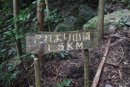
Well I hiked about 500 meters and was breathing heavily already. I decided to carry on. I also made myself go pretty fast because I didn't want to have to drive back in the dark. Plus, it looked like it might rain so I had to make good use of time. The information I read said it was about a 1 hour and 50 minute hike up. It starts to get dark around 5:30 or so up in the hills. But I didn't think it would take that long to hike up. I hoped I was right.
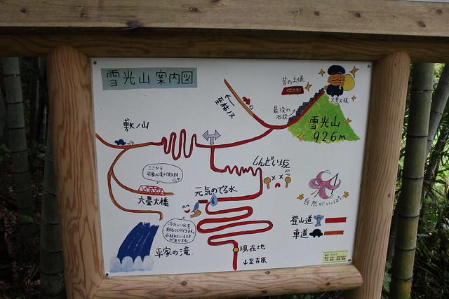
These trail maps are great. I love the drawing for the summit and the guy. The stars make it feel magical. If you look at the middle there is a person who looks like they are dead. They call this part of the trail the しんどい坂 (Shindoi Saka). It means exhaustion slope. They really weren't kidding with the name. It was pretty grueling to go up. I liked the name they gave it though.
About an hour elapsed until I reached the top.
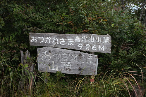
926 meters is 3,038 feet. I probably ascended at least 2,000 feet or more. It felt really great at the top. My glasses were fogging up along the way up because of the heat coming off my face and head. It was good to get some nice breeze. The only disappointing part of the hike was the weather.

It was cloudy and the visibility was low. On a clear day you could see the ocean and Kochi city from this summit toward this direction.
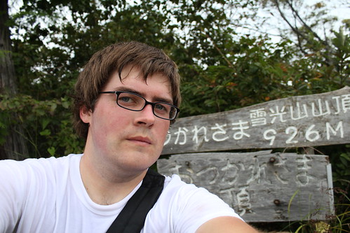
I didn't stay long because it started sprinkling. However, it didn't rain which I was thankful for. I made it back to the car about 4pm and set out back home through the curving roads. Took a shorter time to get back because I knew the road better this time. In all I'm glad to have made it out and done some exploring. I don't know if I'll be back to this mountain soon unless its really nice weather. It was good for a quick afternoon hike and is one of many to hike. Finally, a complimentary picture of myself. So flattering...
1 comment:
ironic or not, you are hiking mountains after living in the flat lands all your life and so are we
Post a Comment